Skip to content
Menu

A booking made through these earns us a commission from Viator. The price is the same, and the commission had no bearing on what is recommended.

Water feature

The Potomac River

Last updated

The larger of the two rivers, the one that cut the gap through the Blue Ridge, and legally Maryland right up to the West Virginia bank.

Photo: Roger PutaPublic domain

Closed at the moment

The park closes the lower town and the towpath during high water. Check the park's alerts page if there has been heavy rain upstream in the previous two days.

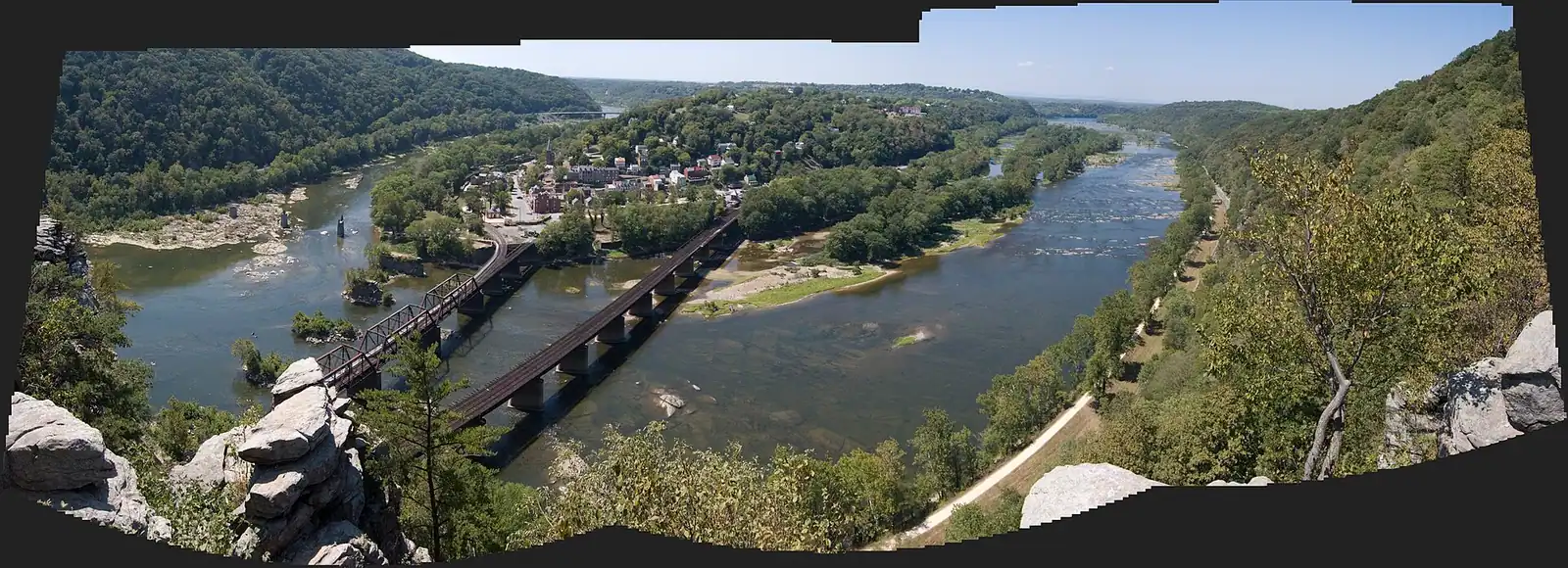
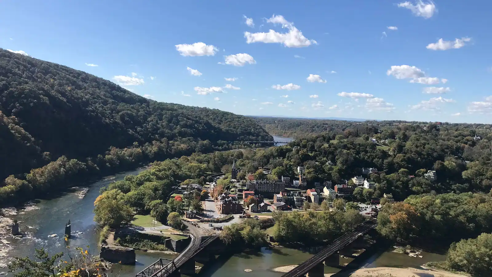
Stand at the confluence and the Potomac is the one coming in from your left, wider and slower than the Shenandoah, sliding under the railroad bridge on its way east. It has run about 285 miles by the time it gets here, gathering the drainage of five jurisdictions, and it is about to do the thing that made this town: cut straight through the Blue Ridge instead of turning to go around it.

That cut is a water gap, and it is why anything is here at all. The ridge runs unbroken for miles north and south. At Harpers Ferry it is sliced open, and through the slot go the river, a canal, a railroad, a highway and a footpath. George Washington noticed the water power before he noticed the scenery and pushed for a federal armoury on this bank in the 1790s. Every later thing — the arsenal, the raid, four years of armies taking the town off each other, the rafting trade — sits downstream of that decision.

The legal geography is stranger than the physical. Maryland's boundary here is not the middle of the channel. It runs to the low-water mark on the southern shore, an inheritance of the colonial charter, which means the entire body of water you are looking at is Maryland and West Virginia's jurisdiction stops at the edge of the bank. It matters if you fish. Check with both states before you buy a licence, because the arrangements between them have changed over the years and the answer that was right on a forum five years ago may not be right now.

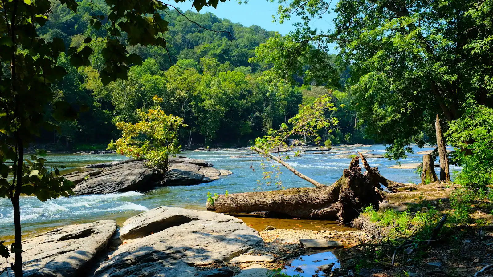
What the river does not offer is a swim. The confluence looks placid from The Point and is not: two rivers of different speed and temperature meeting over ledged bedrock, with the current stronger and the drop-offs sharper than the surface suggests. People do get in. People also get into trouble, and the park would rather you went upstream with an outfitter and a vest.

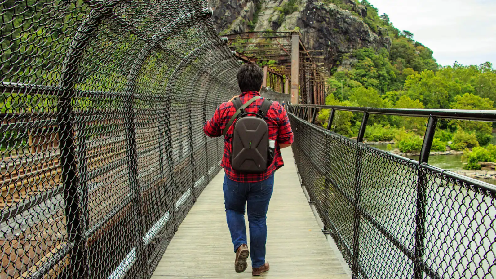
The far bank is Maryland and reachable on foot. The Goodloe Byron Memorial Footbridge, bolted to the side of the railroad bridge, carries the Appalachian Trail across and drops you onto the C&O Canal towpath.
Getting there and parking

The river is unavoidable once you are in the lower town. From the shuttle stop on Shenandoah Street, walk downhill to Potomac Street and keep going to The Point, where the two rivers meet. Three or four minutes, all of it flat.

For the Potomac specifically, carry on past The Point to the steps up to the Goodloe Byron Memorial Footbridge, which runs alongside the railroad bridge to the Maryland bank and the C&O Canal towpath. That is the only pedestrian crossing here. The railroad bridge itself is a working freight line and is not a walkway.

Upstream access for boats is not in the town. Outfitters launch from private and county put-ins along the Shenandoah above Millville and along the Potomac north-west of the gap, and they will tell you where to meet them when you book. There is no public boat ramp in the lower town, and nowhere to leave a trailer.

Why the river cuts through the ridge instead of around it

A water gap is what you get when a river is older than the mountain it crosses. The Blue Ridge rose slowly enough that the Potomac kept sawing down through it rather than being pushed aside, and the result is a notch a few hundred feet deep with a town wedged into the bottom of it.

Everything practical about Harpers Ferry follows. The town sits at about 509 feet, the lowest point in West Virginia, with Maryland Heights at roughly 1,448 feet on one side of the gap and Loudoun Heights on the other. Cold air and heat both pool in the bowl. The sun arrives late and leaves early, which is why a January morning in the lower town can feel an hour behind the ridge above it and why a July afternoon there is genuinely worse than the forecast.

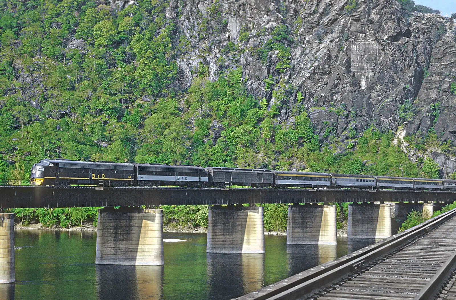
It is also why the gap carries so much traffic. Two railroads, the canal, US 340 and the Appalachian Trail all use the same slot, because there is no other easy way through. Stand on The Point for ten minutes and you will hear a freight train; stand for twenty and you will see a hiker and a kayak inside the same frame.

Telling the two rivers apart from the bank

Visitors mix them up constantly, and the trick is direction rather than colour.

  • The Potomac arrives from the north-west, on your left as you face downstream from The Point. It is the wider one, and the railroad bridge and the footbridge cross it.
  • The Shenandoah comes in from the south-west, on your right, under the twin US 340 road bridges upstream. It is the narrower, shallower, more broken-looking of the two.
  • Downstream of the junction everything is the Potomac. The Shenandoah ends here; it has no further course.

After heavy rain the two often arrive at different colours and run side by side for a few hundred yards before mixing, with a visible seam down the middle. It is the single best five minutes of river-watching in the town and it is free.

The three-state point is a bit of trivia worth getting right too. West Virginia is the bank you are standing on, Maryland is across the Potomac, and Virginia is across the Shenandoah. You can see all three without turning more than about ninety degrees.

Which river the boats are actually on

Almost every trip sold as a Harpers Ferry river trip runs on the Shenandoah rather than the Potomac, and it is worth knowing why before you book.

The lower Shenandoah above town drops through a ledged section known as the Staircase, Class I to III depending on level, with Bull Falls the hardest single drop. That is where the commercial rafting runs, roughly April to October, and where the whitewater is. The Potomac above the confluence is flatter and broader, which makes it the river for flatwater kayaking, canoe touring and the long summer floats when the Shenandoah is too low to be interesting.

Season governs everything. Spring snowmelt and rain push the Shenandoah up and the rafting season opens on the gauge rather than on a date. By July the water has dropped into tubing flow, which is when the Potomac's calmer stretches come into their own and when there is most to book. Trips get moved or cancelled at short notice for thunderstorms and for high water, and an outfitter who calls one off is reading a number you cannot see. Take the cancellation.

What the river has done to this town

The Potomac has taken Harpers Ferry repeatedly, and the ruins you walk through are the evidence.

The record crest is 36.5 feet, in March 1936, which ended habitation on Virginius Island and left the lower town half abandoned. October 1942 brought 33.8 feet and finished much of what was left. There were serious floods in 1870, 1889 and 1924, and one in 1996 closed Virginius Island to visitors until 2003. High-water marks are painted and plaqued around the lower town, and the honest reaction to them is not admiration but arithmetic: you are standing well below several of them.

The practical consequence is simple. When the river comes up, the National Park Service closes the lower town, the towpath, or both, and that closure is the entire advice. There is no clever workaround, no back way in, and no version of the day that still works. Check the park's alerts page the morning you travel if there has been rain upstream in the previous two days, because the water that floods Harpers Ferry falls in Pennsylvania and the Shenandoah Valley rather than here.

Where to look at it from

Four vantage points, in ascending order of effort.

The Point is the obvious one: the tip of land at the junction, three minutes on the flat from the shuttle stop, with both rivers and all three states in one view. Early morning has the mist on the water and nobody else there.

The footbridge puts you out over the middle of the Potomac with the railroad bridge alongside. It is the best place to feel the size of the river rather than look at it, and the only place a freight train will pass within a few feet of you.

Jefferson Rock gives you the Shenandoah gorge running away south-west, which is the view Jefferson wrote about in 1783 and the one that photographs best in the last hour of daylight.

Maryland Heights produces the postcard: the whole town, both rivers, the bridges, from an unfenced ledge above a long drop. It is 4.5 to 6.5 miles round trip and between roughly 990 and 1,788 feet of climbing depending on route, and in summer it belongs to the first two hours of the day.

Tours that visit The Potomac

Operators run these trips past The Potomac, or stop there as part of a longer route. We list what the booking data supports — not everything that mentions the name.

A booking made through these earns us a commission from Viator. The price is the same, and the commission had no bearing on what is recommended.

Shared departurespriced per seat, best value for one or two

  • New River Gorge ATV Adventure Tour

    Curated Catalog

    Likely to sell outInstant confirmation

    New River Gorge ATV Adventure Tour (opens in a new tab)

    127 reviews

    With over 100 miles of trails ranging from beginner to expert, incredible guides, and top of the line ATV's, riders of all skill levels…

    3–4 hours

    Prices checked

    from $195

Private and small-group optionsoften cheaper per head for a family or a group of six

Near The Potomac

Straight-line distances, so allow more on the road — the island is long and has one main parkway.

  • A long steel bridge carrying a walkway across a wide river, with a forested ridge rising behind it

    Viewpoint

    Free

    The Point

    Ninety seconds from the shuttle stop, level the whole way, and the only spot where the town's geography explains itself.

    10–30 minutesFree; covered by the park entrance fee already charged on your vehicle830 ft away

  • A walker crossing a river footbridge with a pack on their back, the far bank thick with trees

    Landmark

    Free

    Appalachian Trail Footbridge

    The walkway bolted to a working railroad bridge that carries the Appalachian Trail over the Potomac — closed since July 2026.

    10–25 minutesFree to cross when open; the park entrance fee applies to your vehicle190 ft away

  • Green trees lining the edge of flat, slow river water under a bright sky

    Trail

    Free

    C&O Canal Towpath

    184 miles of level crushed stone on the Maryland bank, reached by a footbridge and an awkward spiral staircase.

    1–5 hoursFree. The towpath itself carries no entrance fee600 ft away

  • A steel railway bridge with a walkway along its side crossing a wide river below a wooded ridge

    Landmark

    Free

    Harpers Ferry Train Station

    An 1894 B&O station whose platform sits inside the historic district, served by weekday MARC trains and one Amtrak each way.

    10–30 minutesFree to visit. Rail fares are charged by MARC and Amtrak separately620 ft away

The Potomac: common questions

Can you swim in the Potomac at Harpers Ferry?

You should not swim at the confluence. Two rivers of different speed meet over ledged bedrock there, the current runs harder than the surface suggests, and the drop-offs are abrupt. The park discourages it and rescues happen. If you want to be in the water, go with a licensed outfitter on a guided float or tubing trip upstream, wear the flotation they issue you, and accept it when they call the day off for level or weather.

Which river is which at Harpers Ferry?

Facing downstream from The Point, the Potomac comes in from your left and the Shenandoah from your right. The Potomac is the wider one, crossed by the railroad bridge and the footbridge. The Shenandoah is the narrower, shallower one that passes under the twin US 340 road bridges upstream. Everything downstream of the junction is the Potomac. West Virginia is the bank you stand on, Maryland is across the Potomac, Virginia across the Shenandoah.

Do you need a Maryland or a West Virginia fishing licence here?

Check with both states before you cast. Maryland's boundary on this stretch of the Potomac runs to the low-water mark on the southern bank rather than down the middle of the channel, so the water itself is Maryland even where you are standing in West Virginia. The two states have had reciprocal arrangements over the years and the detail has changed. This is one of the few genuinely confusing things about the place, and a ranger or either state's wildlife agency will give you the current answer.

How high does the Potomac flood at Harpers Ferry?

The record crest is 36.5 feet, set in March 1936, with 33.8 feet in October 1942 close behind. High-water marks from both are recorded around the lower town, and they are startling once you work out where you are standing relative to them. The 1936 flood ended habitation on Virginius Island. When the river rises today, the park closes the lower town or the towpath outright, and there is no alternative route in.