Skip to content
Menu

A booking made through these earns us a commission from Viator. The price is the same, and the commission had no bearing on what is recommended.

Viewpoint

Jefferson Rock

Last updated

A propped shale slab above the Shenandoah gorge, and the spot that gave American travel writing its first great sentence.

Thomas Jefferson climbed up here on 25 October 1783, looked down the gap where the Potomac and the Shenandoah leave the Blue Ridge, and wrote it up two years later in Notes on the State of Virginia. He called the scene worth a voyage across the Atlantic. That single line did more for this town's tourist trade than anything else in its history, and people have been walking up the stone steps to check it ever since.

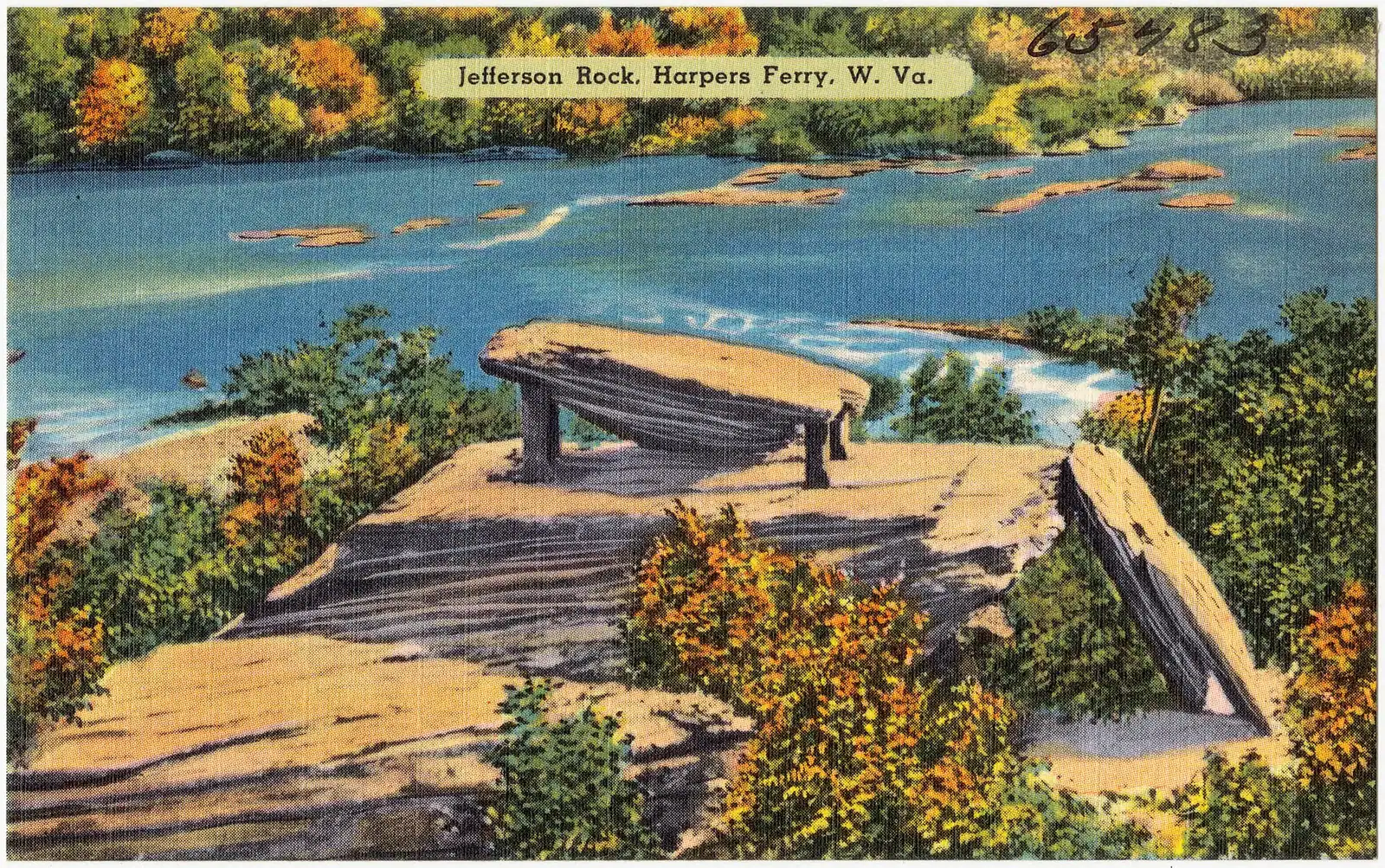
The rock itself is a slab of the local shale, a grey, splintery, thinly bedded stone that breaks into plates and does not weather kindly. The top slab sits on four squared sandstone pillars, and those are not decorative. By the middle of the nineteenth century the thing had become a hazard: visitors rocked it for entertainment and chipped pieces off it for souvenirs, and somebody in authority decided that the most famous rock in Virginia should be prevented from falling into the Shenandoah. The pillars have been there ever since, which means that the outcrop you photograph has been under repair for longer than most American buildings have existed.

Getting up is the interesting part. From High Street a flight of stone steps was cut into the hillside in 1810, and they are still the route: worn, uneven, steep in places and slick after rain. They pass St Peter's Catholic Church and the shell of St John's Episcopal Church, and they carry the Appalachian Trail, so on a spring afternoon you will share them with people carrying eighty-litre packs.

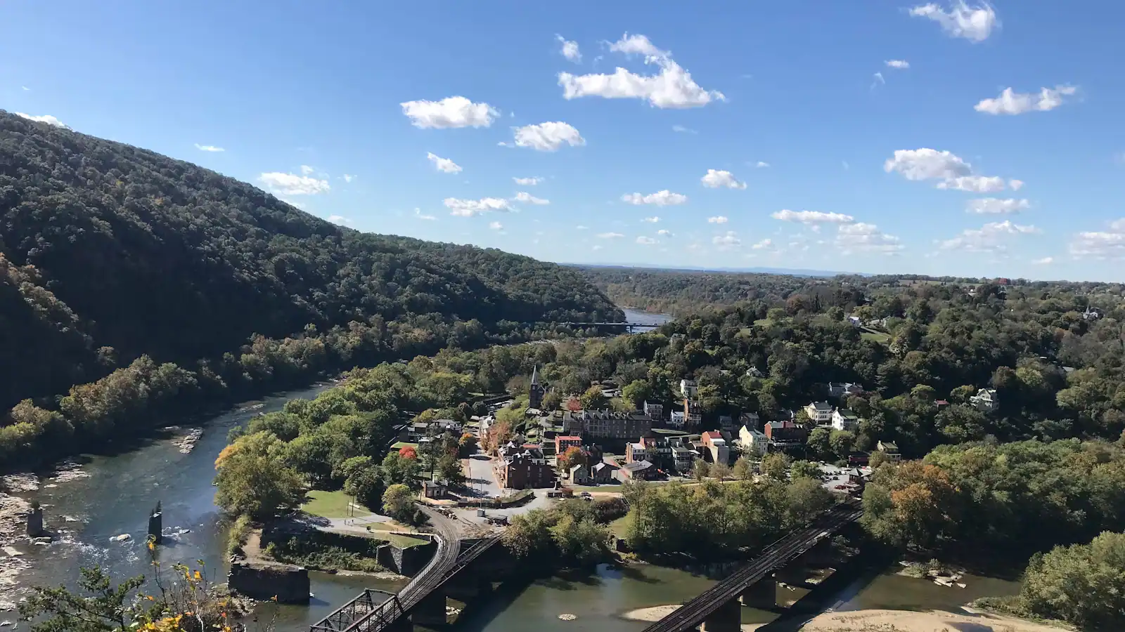
The view is south-west, down the Shenandoah between Loudoun Heights on the left and the Camp Hill slope on the right. In August it is a tunnel of green with the river glinting through it. From November to April, with the leaves down, it is the view Jefferson actually described — the water gap, the bedding planes tilted in the cliff opposite, and the shape of the land that explains why every army that came here fought for the high ground first.

Getting there and parking

From the shuttle stop in the lower town, cross Shenandoah Street and climb High Street. At the top of the shopfronts the stone steps cut up to the right, signed for the Appalachian Trail and Jefferson Rock. Ten to fifteen minutes at a steady pace, longer if you stop at the churches.

Coming off the Appalachian Trail from the south, you pass it without trying — the trail runs directly along this bench of the hillside between Camp Hill and the lower town.

There is no vehicle access of any kind and no drop-off point. The nearest parking is the visitor centre lot on Cavalier Heights, which means the shuttle and then the climb. Anyone who cannot manage worn stone steps without a handrail should plan on Bolivar Heights or The Point instead, both of which give you a genuine view on level ground.

The stone steps, and what they are like

From the shuttle stop it is a ten to fifteen minute walk, almost all of it up. Cross Shenandoah Street, climb High Street past the shopfronts, and look for the stone steps on the right at the top.

Those steps date from 1810 and have been walked on ever since. They are stone, worn concave in the middle, irregular in height and without a continuous handrail. Wet leaves in late October and ice in January are the two things that catch people out, and the descent is where injuries happen rather than the climb.

There are three stopping points on the way up, and all three are worth the pause. St Peter's Catholic Church comes first, its spire on the edge of the drop. Then the ruin of St John's Episcopal Church — roofless, walls only, and quieter than anything else in the park. Then the rock, a couple of minutes beyond.

Allow half an hour up and back if you are only going to the rock, an hour if you continue along the ridge to Camp Hill and the Storer College buildings, which is the better walk and the one most day-trippers miss.

Proper shoes. Not sandals. This is the single most common footwear mistake made in this town.

What Jefferson got right, and what he got wrong

Jefferson read the landscape as a catastrophe. His account describes the two rivers pressing against the mountain, breaking through it and tearing the ridge apart — a single violent event, with the water gap as the wound.

It is magnificent writing and it is not what happened. Geologists now read the sequence the other way round. The rivers are older than the ridge in its present form. As the rock rose, the water kept cutting down through it, at roughly the rate the land came up, over a span of time that has no useful comparison in human experience. Nothing burst. Nothing was rent asunder. The river simply refused to be diverted, for millions of years, and the gap is the record of that patience.

You can see the evidence from the rock if you know to look for it. The cliff faces opposite are not horizontal. The bedding planes are tilted and folded, pushed over during the mountain-building that raised the Appalachians, and the rivers cut across that structure rather than following it. A stream that formed after the ridge would have gone round.

None of which diminishes the sentence. Jefferson was a careful observer working two generations before anyone had the framework to interpret what he was seeing, and he was honest enough to describe what the place looked like rather than what a theory required.

Season, light and the leaf problem

The single biggest variable here is foliage, and most visitors arrive in exactly the wrong month for the view.

June to September. The canopy closes. You get a green corridor with fragments of river through it, pleasant enough but not the view in the history books. Early morning is better than midday because the light comes down the gorge rather than straight into the lens.

Mid to late October. Colour on both ridges, and the busiest fortnight of the year on these steps. Come on a weekday or on the first shuttle.

November to March. The best months, and almost nobody says so. Leaves down, sightlines open, the tilted rock in the opposite cliff visible, the rivers full and loud. Ice on the steps is the catch, and microspikes in January are not an overreaction.

Last hour of daylight, any season. The gorge runs south-west, so late sun comes straight up it. This is the reason photographers keep returning, and it is worth structuring a day around: lower town in the morning, the heights in the middle, this at the end.

Remember that the last shuttle back to Cavalier Heights leaves the lower town at seven in summer and half past five in winter.
Standing on it, and why you cannot

Nineteenth-century photographs show parties of visitors sitting on top of the slab in their Sunday clothes. That is no longer how it works, and the reason is in the stone.

The Harpers shale here is thin-bedded and it sheds. The slab was unstable enough by the 1850s that it had to be propped, and the propping has been renewed since. Treat the outcrop as something to look at and photograph rather than to climb, and keep children away from the drop on the river side, which is unfenced in places and steeper than it looks through trees.

The viewing area is small. On an October Saturday there is effectively a queue for the good angle, and people are patient about it in a way that says something decent about the visitors this place attracts.

Two more practical notes. There are no restrooms, no water and no shade beyond the trees on the whole climb, so fill up in the lower town. And the Appalachian Trail runs through here, so if a walker in a large pack wants past on the steps, they have four hundred miles behind them and a right to the inside line.

Near Jefferson Rock

Straight-line distances, so allow more on the road — the island is long and has one main parkway.

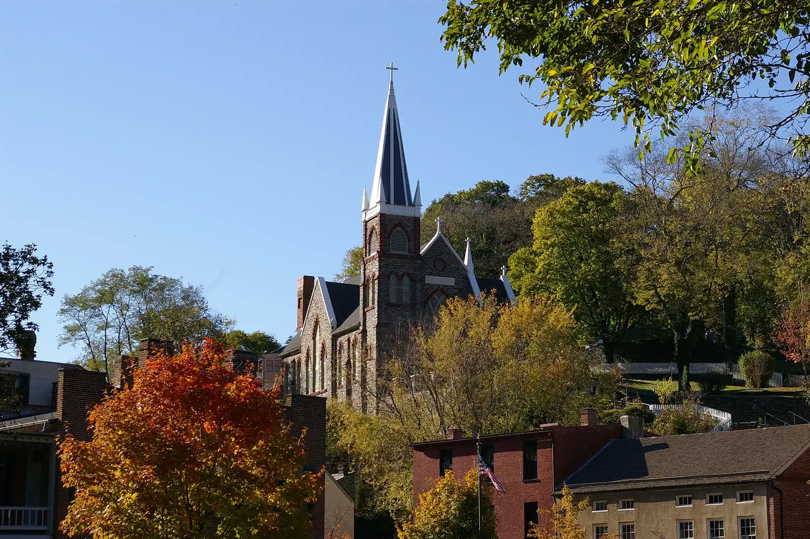
  • A brick church with a steep slate roof and a pointed steeple standing above a hillside of trees

    Historic site

    Free

    St Peter's Catholic Church

    The spire in every aerial photograph of this town, and the only church here that came through the war standing.

    10–30 minutesFree; the park entrance fee applies to your vehicle but the church charges nothing420 ft away

  • A narrow street of nineteenth-century shopfronts climbing between stone kerbs

    Shopping

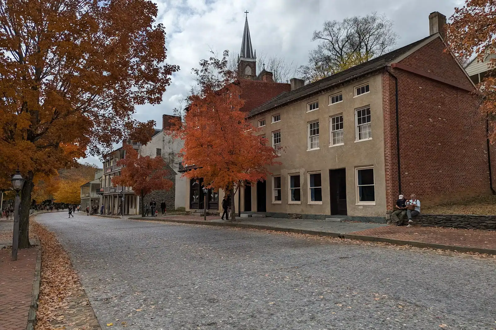
    High Street

    The lower town's one commercial street: a stone climb of shopfronts ending at the steps up to St Peter's and Jefferson Rock.

    0.5–1.5 hoursThe street is free to walk; reaching it means entering the national historical park420 ft away

  • A whitewashed stone-walled house standing on a steep bank above a dry stone retaining wall

    Neighbourhood

    Camp Hill

    The terrace above the lower town: Storer College, the 1906 Niagara Movement meeting, and the view without the queue.

    1–1.5 hoursIncluded with park entrance; the grounds carry no separate charge0.3 mi away

  • A narrow street of nineteenth-century shopfronts running uphill between stone kerbs

    Neighbourhood

    Lower Town Harpers Ferry

    Two streets and a flight of stone steps, all of it inside a national park, with the high-water marks still on the walls.

    2–5 hoursPark entrance fee applies; National Park Service exhibit buildings are then free to enter910 ft away

Jefferson Rock: common questions

How hard is the walk to Jefferson Rock?

Short but steep. From the shuttle stop in the lower town it is ten to fifteen minutes, climbing High Street and then a flight of stone steps cut into the hillside in 1810. The steps are worn concave, irregular in height and lack a continuous handrail, and they are slick with wet leaves in autumn and ice in winter. Most reasonably mobile adults manage it comfortably in proper shoes. There is no step-free alternative and no vehicle access.

Can you stand on Jefferson Rock?

No. Nineteenth-century photographs show visitors sitting on the slab, but the stone is thin-bedded shale that sheds, and it had become unstable enough by the 1850s that the upper slab was propped on four sandstone pillars to stop it going into the river. You view it from the path beside it. The surrounding ground is unsurfaced and sloping, and parts of the drop on the river side are unfenced, so keep children close.

What did Thomas Jefferson say about Harpers Ferry?

He visited on 25 October 1783 and described the scene in Notes on the State of Virginia, published in 1785, judging it worth a voyage across the Atlantic. He read the water gap as the result of a single catastrophic breaking-through of the ridge by the two rivers. Modern geology reverses that: the rivers are older than the ridge in its present form and cut down through the rock as it rose, over millions of years.

When is the best time to visit Jefferson Rock?

Between November and April, which is the opposite of what most visitors do. With the leaves down you get the wide view down the Shenandoah gorge that Jefferson described, including the tilted rock beds in the cliff opposite. In summer the canopy closes it into a green corridor. Late October gives you colour and the heaviest crowds of the year. Whatever the season, the last hour of daylight is the best light, because the gorge runs south-west.